The Tomb of Daniel_ Khuzestan
 The Tomb of Daniel is the traditional burial place of the biblical prophet Daniel. Various locations have been named for the site, but the tomb in Susa, Khuzestan, is the most widely accepted. The Book of Daniel mentions that Daniel lived in Babylon and may have visited the place of Susa, but the place where he died is not specified; the tradition preserved among the Jews and Arabs is that he was buried in Susa. Today the Tomb of Daniel in Susa is a popular attraction among local Muslims and Iran's Jewish community alike.The surrounding landscape today is a desolate plain beside a meandering river with a central hilltop where an armed fortress palace or citadel once stood in all its glory.
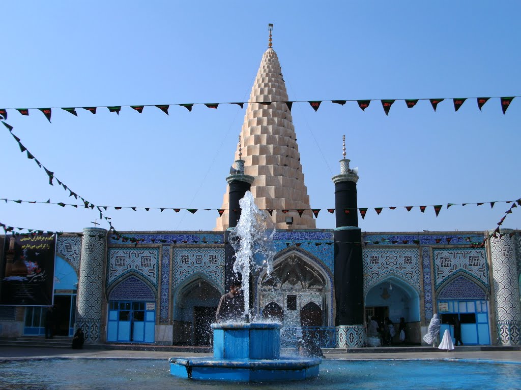
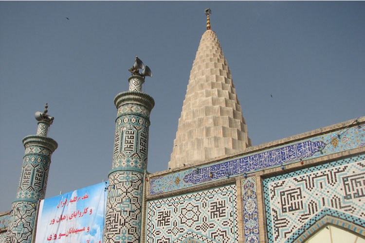 The tomb is a building surmounted by a pineapple cone in white plaster and it is clearly of no great antiquity. The premises have two courtyards, which are surrounded with chambers and porches. The mausoleum is located at the end of the second courtyard, which has rooms in three side of courtyard for a nights stay of pilgrims. In this mausoleum, the sepulchre below the tomb is an old yellow colored stone devoid of any inscriptions.The ceiling of the mausoleum has beautiful mirror works with light apertures on eight sides under the dome. The foundations of the mausoleum are old but thick and strong. The upper section of eastern side of mausoleum is adorned with tile works. The dome of is hexagonal in shape and erected on a circular base.
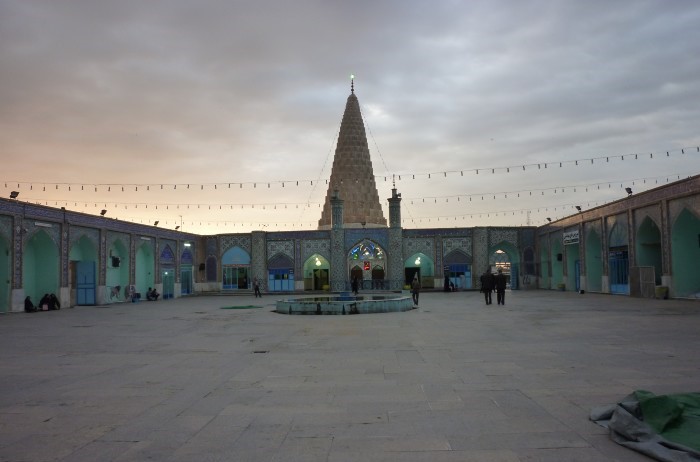
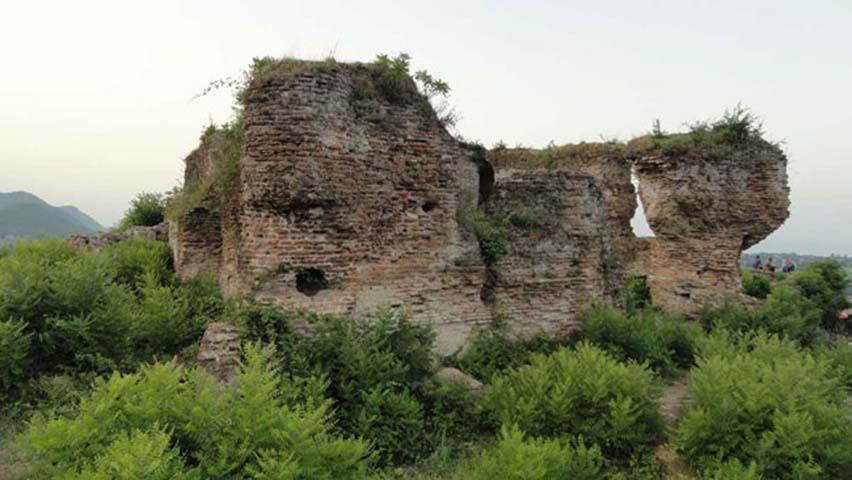 Iran’s Cultural Heritage and Tourism Organization has recently been granted the ownership of this Sassanid Fort, a very welcome move as for years Salasel Fortress has been utilized as a storage area for keeping goods by different organizations including the Grain and Sugar Organization, Drug Control Headquarters and Khomeini Relief Fund.For many years this Sassanid Fortress did not have any legal
 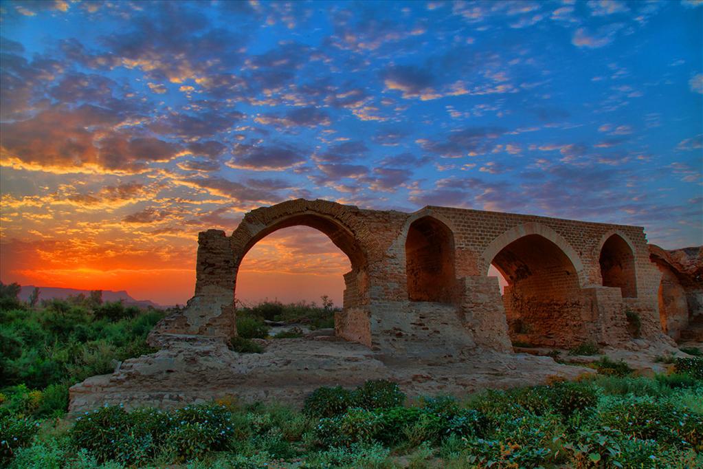 The Shadravan Bridge is located on the Karoon River in Khuzestan province and dates back to the Sassanid era. It currently runs parallel to the newly constructed bridge located on the Shushtar-Dezful Road. The bridge was once 550
 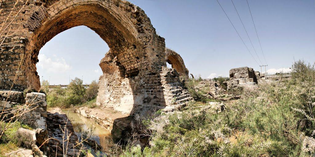 Shadravan Bridge, also called Shapuri, is located some 300 meters west of Mizan Dam. Its pillars are 7 meter wide, its water passage 8 meters wide, and its height, from the base to the arch crown, around 10 meters. The
 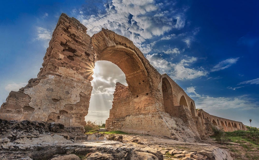 The Bridge was built in the Sassanid era, during the rule of Shapur I, to transfer water to the Khuzestan plain, to protect the
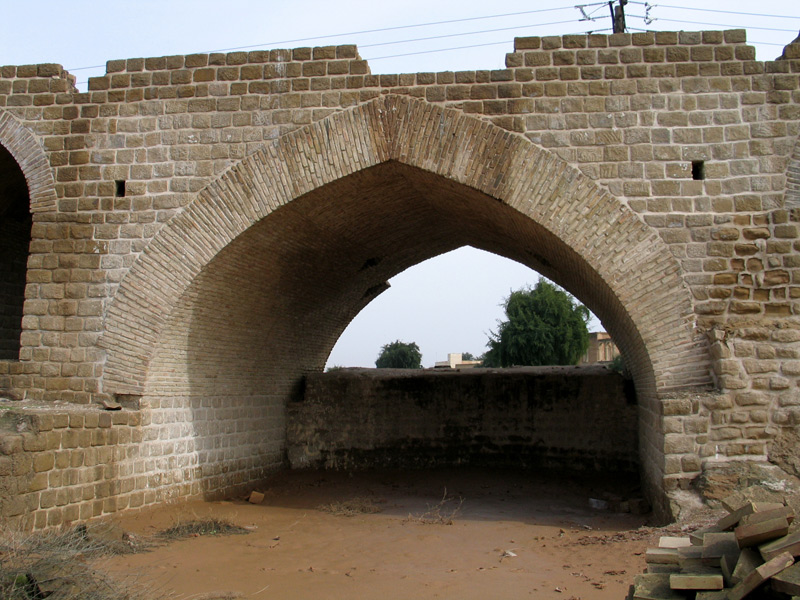
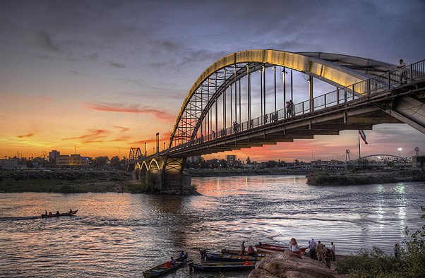
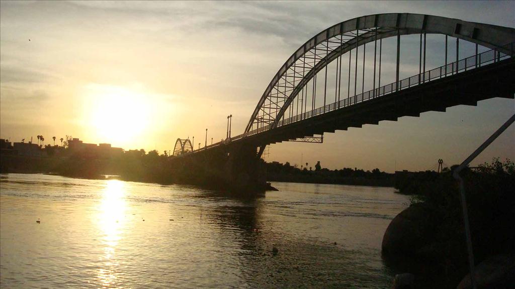 The Karoon River is Iran's most effluent, and its only navigable, river. It is 720 km long and rises in the Zard Kooh mountains of the Bakhtiari district in the Zagros range, receiving many tributaries, such as the Dez and the Koohrang, before passing through the capital of the Khuzestan province of Iran, the city of Ahvaz.
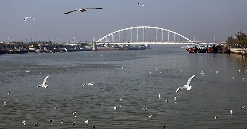 The Karoon continues toward the Persian Gulf, forking into two primary branches on its delta: the Bahmanshir and the Haffar that joins Arvand River, emptying into the Persian Gulf. The important Island of Abadan is located between these two branches of the Karoon. The port city of Khorramshahr is divided from the Island of Abadan by the Haffar branch. Seasonal variation in discharge rate shows the lowest water level to be in October, and the highest, as the result of combined precipitation and meltwater, in April.
 The Karoon up to Ahvaz was opened to international navigation in 1888, and boat services were later established between Ahvaz and Band Qir. Shipping on the lower course of the Karoon has become increasingly important owing to oil drilling and refining in the vicinity. To increase the water supply of Isfahan, a dam and tunnel on the river were completed in 1971.
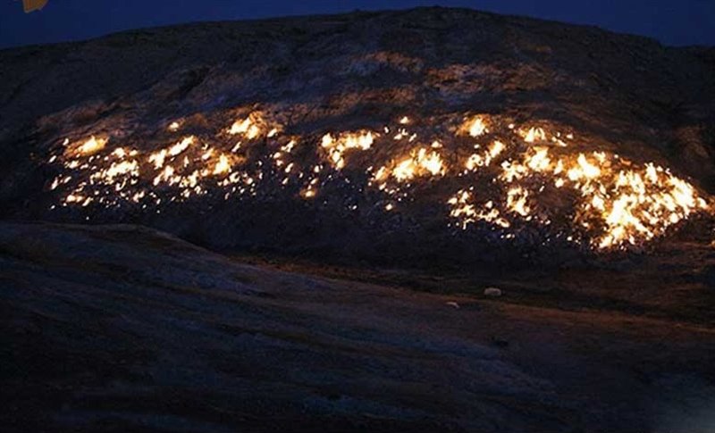 Tashkooh is a mountain in Ramhormoz, Khuzestan on the way to Roodzard and past the village of Gonbad Loran. The mountain is known as Tashkooh, abbreviated from Atashkooh, named as a result of continuous burning slopes since ancient times.
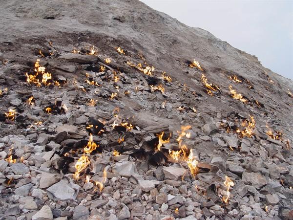 According to experts, the reason for its burning nature is the presence of sulfur beneath the mountain along with the ascending of natural gas from far below to the Earth’s surface in this particular location. Such gases, consisting of hydrocarbons, pass through the various layers of the earth and eventually break through the surface cracks, combusting on their way out. Such cracks operate exactly as fresh water springs would, except that rather than water they act as an outlet for fire.
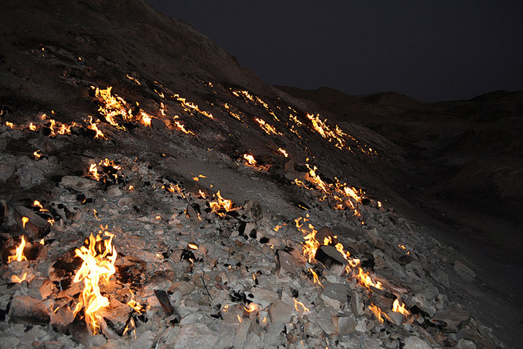 The mountain is approximately 50 meters off of the main road and very visible for passersby, especially at night. Unfortunately for tourists interested in viewing this natural phenomenon there are no signs or brochures to lead them here and their only guide to Tashkooh’s whereabouts is assistance from the locals. For those interested in paying this site a visit, the best way to access it is to take the Ramhormoz road towards Izeh and follow the signs towards Abolfars. After passing a metal bridge, Tashkooh should be in sight on your left.
 Hi dear friends. I am NAVID TAHMASEBI (English instructor & Inbound manager of Tavrizh parvaz travel & tourism agency)and I was Born in Tabriz. This weblog is created to introduce IRAN for passengers from all around the World.